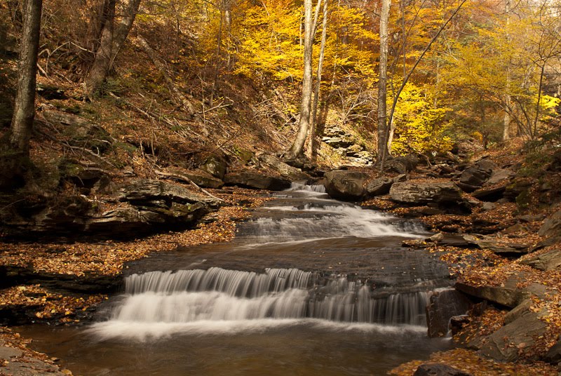
Today's Photo - Ricketts Glen StatePark, PA Fall, 2010
Today I'm going to post some information about one of my favorite Pennsylvania State Parks, Ricketts Glen. It is about 180 miles from Oswego, a 4 hour or so drive. So far I've been there 3 times. The first was in 2001 as a stop on a tour of Pennsylvania in a rented 31' Fiesta Class A RV. If you are interested in reading about the trip, I have a couple of pages starting here.
 Summer, 2001
This was taken with my last Point & Shoot camera, a Coolpix 995 (I still have & use it).
The second trip was part of Spring 2010 trek that combined family visits with a photo excursion to both Babcock State Park in West Virginia & Ricketts Glen. More about that trip Here.  Spring, 2010
The problem with trips in the Spring, other than being a bit cold, is although you generally have more water going over the falls, the bare trees don't add much color to the images.
The most recent trip was this Fall.
In any case, some information about the park: The park has a large lake for swimming and boating (electric motors only), a 2 section campground (Map - 197 KB PDF)) , one of which is usually open in winter, although when I checked their website I discovered budget problems have closed the entire park until April.
A PDF (267KB) map showing the locations of the waterfalls is here. A large PDF (2.6MB) of the entire park is here.
A couple of notes:
- If you are entering the park from Red Rock (PA 118/487), the south entrance, be sure your vehicle is capable of a long steep grade. The park advises heavy trailers to enter from the North on PA 487 from Dushore.
- The Falls Trail(s) is described as "Most Difficult" by the park. Although it does require a fair amount of climbing (after all, you are following the drop of 100's of feet of waterfalls), there are steps for the steepest parts, and, if you take your time, and can walk on uneven ground, it is doable by anyone is reasonably good health.
- If you are not camping in the park, the easiest way to see the falls is to park at the bottom (there is a parking lot at the lower end of the falls stream on PA 118) and walk up to the falls. The advantage is you get to go downhill on the way home. Even better is to have someone drop you off at the top of the Ganoga Glen Trail & pick you up at the PA 118 parking lot - it is downhill all the way!
- The stream splits at "Waters Meet" - you need to choose which leg you want to travel. The Ganoga Glen (left side going up) is the more popular & has the highest falls (Ganoga Falls, 94'). If you want to see the entire collection of falls, you can cross at the top of Ganoga Glen on the Highland Trail & return to "Waters Meet" on the right portion of the stream (Glen Leigh).
- Plan on 4 - 6 hours if you are going to do both loops and stop to view the waterfalls - it is about 5.8 miles round trip from the lower parking lot.
- Along with the named waterfalls there are hundreds of cascades along both streams. Take your time and enjoy the park!